The Delhi Development Authority (DDA) has launched an interactive GIS-based map for the Land Use Plan under the Master Plan for Delhi-2047.
This will allow residents to check the designated land use of an area or property online without visiting DDA offices or relying on intermediaries.
The GIS-based map is available on the DDA website under the “Master Plan for Delhi-2047” section. Citizens and other stakeholders can search for a location, area or property and view its designated land-use category directly on the digital map.
Also Read: Delhi Launches GIS-Based Digital Database of Road Infrastructure for Better Planning
DDA Map Brings Multiple Planning Layers Together
The digital platform brings several planning datasets into one interface. These include Land Pooling Areas, Transit-Oriented Development (TOD) Zones, Dwarka Sub-City, Rohini Project Layout, PM-UDAY Colonies, DDA Parks and other thematic layers.
The MPD-2047 layer shows proposed land use across different parts of Delhi, while the Land Pooling and TOD layers indicate areas covered or proposed under those planning frameworks.
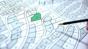
The Land Use Plan covers nine major categories: Residential, Commercial, Industrial, Recreation, Transport, Utility, Government, Public and Semi-Public Facilities, and Agriculture & Water Body. Different colours distinguish the categories.
Also Read: AMC to Spend ₹240 Crore on Fresh GIS Mapping of Ahmedabad Despite Earlier Survey
Plot-Level Search and Measurement Tools Added
The GIS-based map lets users zoom to the plot level and identify a specific property or location. It provides a more detailed, location-specific view than conventional 2D maps prepared at a fixed scale.
Users can also measure distances and dimensions, including the width or length of a road or plot. Drawing and sketching tools allow users to mark areas on the map for personal reference and analysis.
DDA said the Land Use Plan will be continuously updated as new data becomes available. The platform is intended to give citizens, planners, professionals, government agencies and other stakeholders easier access to planning information for preliminary planning and infrastructure and development assessments.
The digital approach will improve transparency, access to planning information and Ease of Doing Business. It also creates a foundation for integrating spatial data from multiple sectors and agencies, in line with initiatives such as AMRUT and the PM Gati Shakti National Master Plan.
The central shift is from static land-use information to a continuously updated digital map that can be accessed and examined at the property level. For Delhi’s planning ecosystem, the platform brings land-use, development and infrastructure-related information into a single digital interface.

Samarjit Kaur is a journalist and communications professional covering technology & emerging digital trends. With a focus on clarity and context, she reports on developments shaping industries and governance. When not reporting, she chooses to plug-in and relax on her playlists and plan her next bucket-list trips!