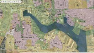
Nagaland has stepped up preparations for the country’s next digital census exercise by leveraging geospatial technology. The Nagaland GIS & Remote Sensing Centre conducted a specialised technical workshop for officials from the Directorate of Census Operations (DCO), Nagaland.
The workshop, held in Kohima, focused on how GIS mapping can support the state’s transition to a more accurate, digitally driven Census process. The development comes as Nagaland advances preparations for Census 2027, expected to be conducted through digital platforms and paperless systems.
Also Read: NCR Regional Plan 2041: Four Namo Cities, 30-Minute Travel Vision Set to Reshape Delhi-NCR
GIS Mapping to Improve Census Accuracy
Addressing the workshop, Senior Project Director Mhathung Kithan said the Nagaland GIS & Remote Sensing Centre currently manages more than 350 digital map layers covering the state.
According to officials, every village and Urban Local Body (ULB) in Nagaland has already been georeferenced and digitised, creating a strong foundation for future Census operations.
The workshop demonstrated how GIS tools, digital mapping systems and Unmanned Aerial Vehicles (UAVs) can help officials identify households with greater precision, reduce duplication and improve the quality of population data collection. Officials noted that location-based data can significantly strengthen planning, monitoring and post-enumeration analysis.
Also Read: Gujarat Unveils India’s First GIS-Based Reservoir Management System to Modernise Water Governance
Digital Census Preparations Gather Pace
The GIS workshop forms part of a wider state effort to modernise Census operations. Nagaland has already trained 130 field trainers across its 17 districts, who are now supporting the training of supervisors and enumerators. More than 6,000 government personnel are expected to be involved in the Census exercise across the state.
The state has also introduced online self-enumeration and digital data collection systems as part of its Census readiness programme. Officials believe that using geospatial technology will help ensure comprehensive household coverage, especially in remote and challenging terrain.
Also Read: UP to Map the Future of 93 Tier-II Towns with GIS-Based Master Plans Under AMRUT 2.0
Smart Governance Through Location Intelligence
The workshop highlights a growing trend among Indian states to integrate GIS, digital mapping and location intelligence into governance programmes. For Nagaland, the move is expected to improve the reliability of demographic data, which plays an important role in policy planning, infrastructure development and public service delivery.
As governments increasingly adopt smart governance tools, Nagaland’s GIS-backed Census framework could become a model for data-driven administration in the North-East.
The workshop underscores how geospatial technology is moving beyond mapping and becoming a core part of digital governance. For India’s emerging smart cities and digital public infrastructure ecosystem, accurate location-based data is quickly becoming as valuable as the data itself.

Samarjit Kaur is a journalist and communications professional covering technology & emerging digital trends. With a focus on clarity and context, she reports on developments shaping industries and governance. When not reporting, she chooses to plug-in and relax on her playlists and plan her next bucket-list trips!