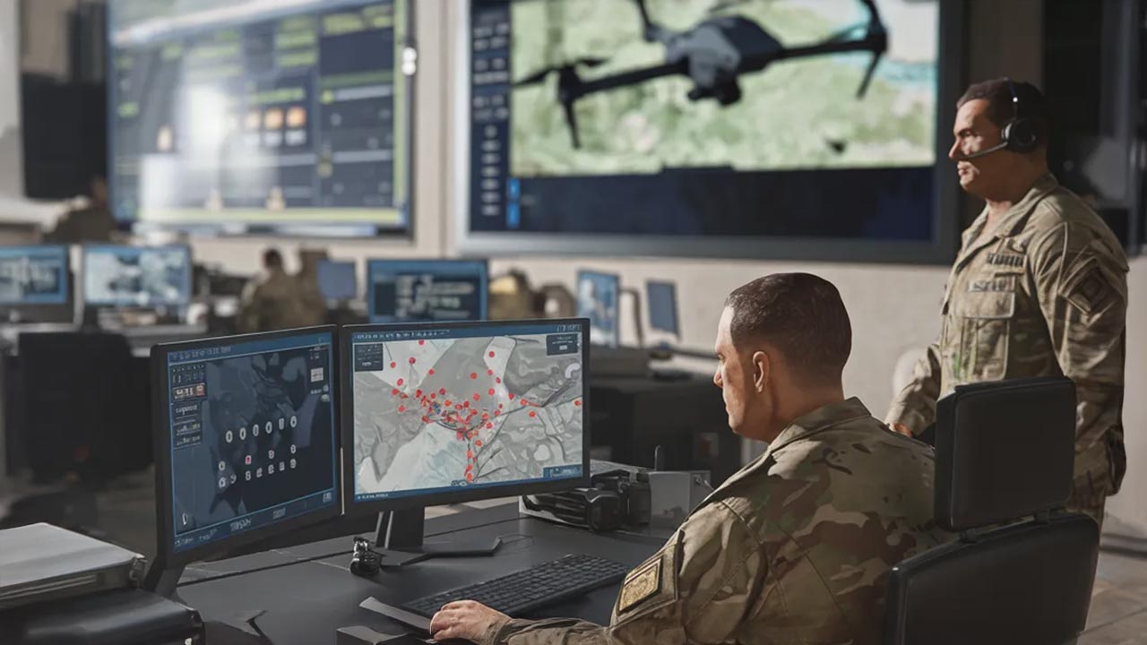
Artificial Intelligence (AI) and Geographic Information Systems (GIS) are changing how defence organisations plan missions, analyse threats and make battlefield decisions, as militaries increasingly move from reactive responses towards predictive intelligence capabilities.
By combining real-time geospatial data with AI-driven analysis, defence forces can improve situational awareness, strengthen mission planning and make faster, data-backed decisions across intelligence gathering, surveillance, terrain analysis and infrastructure management.
India Strengthens Defence Capabilities with AI-Powered GIS Systems
India has already started integrating GIS and AI into its defence ecosystem through initiatives such as the Indian Army’s SANJAY and Avgat projects.
SANJAY is a battlefield surveillance system that combines multiple surveillance inputs with AI to provide real-time battlefield awareness and support faster operational decisions.
Avgat strengthens multi-domain spatial awareness by bringing together satellite imagery, weather information, terrain data and other geospatial datasets on a common operational platform.
Together, these systems highlight the growing role of geospatial intelligence in India’s defence modernisation efforts.
Also Read: Artificial Intelligence-Quantum Tech to Power India’s Future Defence Strategy, Says Jitendra Singh
GIS Creates a Common Operational Picture For Commanders
One of the key advantages of GIS in defence is the creation of a Common Operational Picture (COP), a shared visual representation of a battlefield or operational area.
COP allows different levels of command to access the same information, including terrain conditions, weather updates, intelligence reports, potential threats and operational risks.
With three-dimensional simulations and advanced mapping tools, commanders can assess mission scenarios more accurately, identify vulnerabilities and plan operations with greater precision.
GIS-based terrain analysis also enables military planners to study factors such as elevation, vegetation, visibility, movement routes and possible obstacles before deployment.
Also Read: New Phase in Defence Technology Modernisation for India, AI-Enabled S-400 Received
GeoAI and Digital Twins Reshape Future Warfare
The integration of AI with geospatial data, known as GeoAI (Geospatial Artificial Intelligence), is helping defence forces process large volumes of information and identify threats faster.
GeoAI can reduce intelligence analysis cycles from days to minutes by detecting patterns across multiple data sources and generating actionable insights for commanders.
Digital twin technology is also gaining importance in defence planning. Using drone and satellite imagery, defence teams can create realistic 2D maps and 3D virtual environments for training, simulation, asset management and mission preparation.
Also Read: Paras Defence Wins Exclusive India Rights to Build Guardian-1 Counter-Drone Interceptor
GIS Becomes the Digital Foundation for Modern Defence
Beyond battlefield operations, GIS supports logistics planning, asset tracking, infrastructure monitoring and coordination between defence agencies.
As modern warfare becomes increasingly data-driven, the ability to achieve decision superiority, moving faster from observation to understanding and action, is becoming a strategic advantage.
The future of defence will depend not only on acquiring advanced platforms but also on building intelligent systems that can convert complex data into timely decisions. GIS, AI and geospatial intelligence are expected to become central pillars of national security planning as countries prepare for increasingly connected and information-led conflicts.

Samarjit Kaur is a journalist and communications professional covering technology & emerging digital trends. With a focus on clarity and context, she reports on developments shaping industries and governance. When not reporting, she chooses to plug-in and relax on her playlists and plan her next bucket-list trips!