Mumbai’s civic body is planning to test a new approach to address urban sanitation. BMC plans to combine citizen participation with digital mapping tools.
The pilot initiative will allow residents to suggest cleanliness improvements, supported by Geographic Information System (GIS) mapping to track problematic areas & monitor outcomes.
Also Read: GIS-Led Infrastructure Overhaul for Nagpur to Improve Road Conditions
Citizen Participation to Shape Local Cleanliness Solutions
The intent behind BMC’s pilot programme is to involve residents directly in identifying sanitation gaps across neighbourhoods.
Citizens will be encouraged to submit ideas and flag issues related to waste management, public hygiene and maintenance.
“The plan seeks to create a structured channel for public input, moving beyond complaint-based systems. The focus will be on actionable suggestions that can be tested at a ward level. Selected proposals will be implemented on a trial basis, allowing authorities to measure the results before scaling.”
-said BMC officials
The progress is part of the broader strategy to strengthen community ownership in maintaining public spaces. This is particularly true for dense urban pockets where sanitation challenges vary widely.
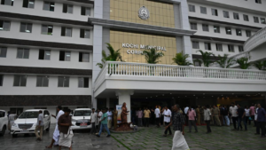
Also Read: Kochi Corporation Improves GIS Mapping to Boost Property Tax Revenue & Urban Governance
GIS Mapping to Track Waste & Monitor Impact
Alongside citizen input, the BMC will use GIS-based mapping to identify sanitation hotspots and track waste-generation patterns. The technology will support civic teams to visualise data in real time, enabling targeted interventions.
Officials noted that GIS tools can improve coordination between departments by offering location-specific insights. This includes mapping garbage collection routes, identifying high-dump zones and monitoring the performance of cleanliness drives.
The integration of digital mapping with citizen feedback will provide a base for data-driven decision-making. It may also help improve accountability by measuring the impact of implemented ideas over time.